
NORWOOD, Massachusetts, USA (December 14, 2023) – Today DotProduct is proud to announce its partnership with Carlson Software for the release of Carlson Scan3D. This new application from Carlson is custom developed on DotProduct's award-winning Dot3D scanning platform and built for the land survey, mining, and construction industries currently served by Carlson Software. It delivers simple, fast, and accurate 3D handheld scanning from both Windows and iOS mobile devices.
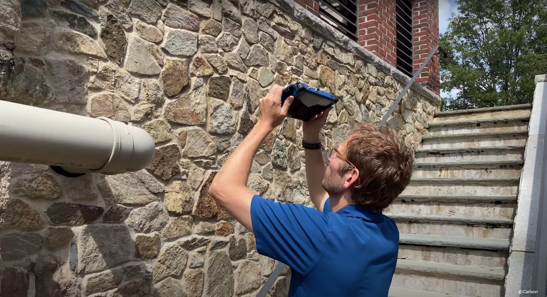
Scan3D represents a powerful new addition to the larger suite of Carlson hardware and software solutions. Existing Carlson rugged data collectors are now being transformed into accurate handheld 3D scanners via Scan3D™ and Intel® RealSense™. Users of Carlson GNSS receivers are now able to instantly capture and geo-reference Scan3D point cloud data right from the same rugged tablet that operates the receiver. Meanwhile, Scan3D is also complimenting drone photogrammetry and other traditional scanning methods by providing point cloud information for those impossible-to-view spaces such as building facades and other areas obscured by overhangs or foliage.
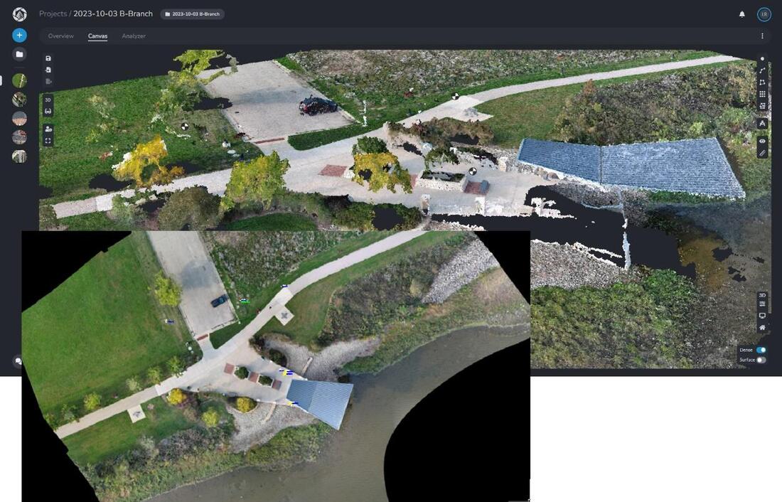
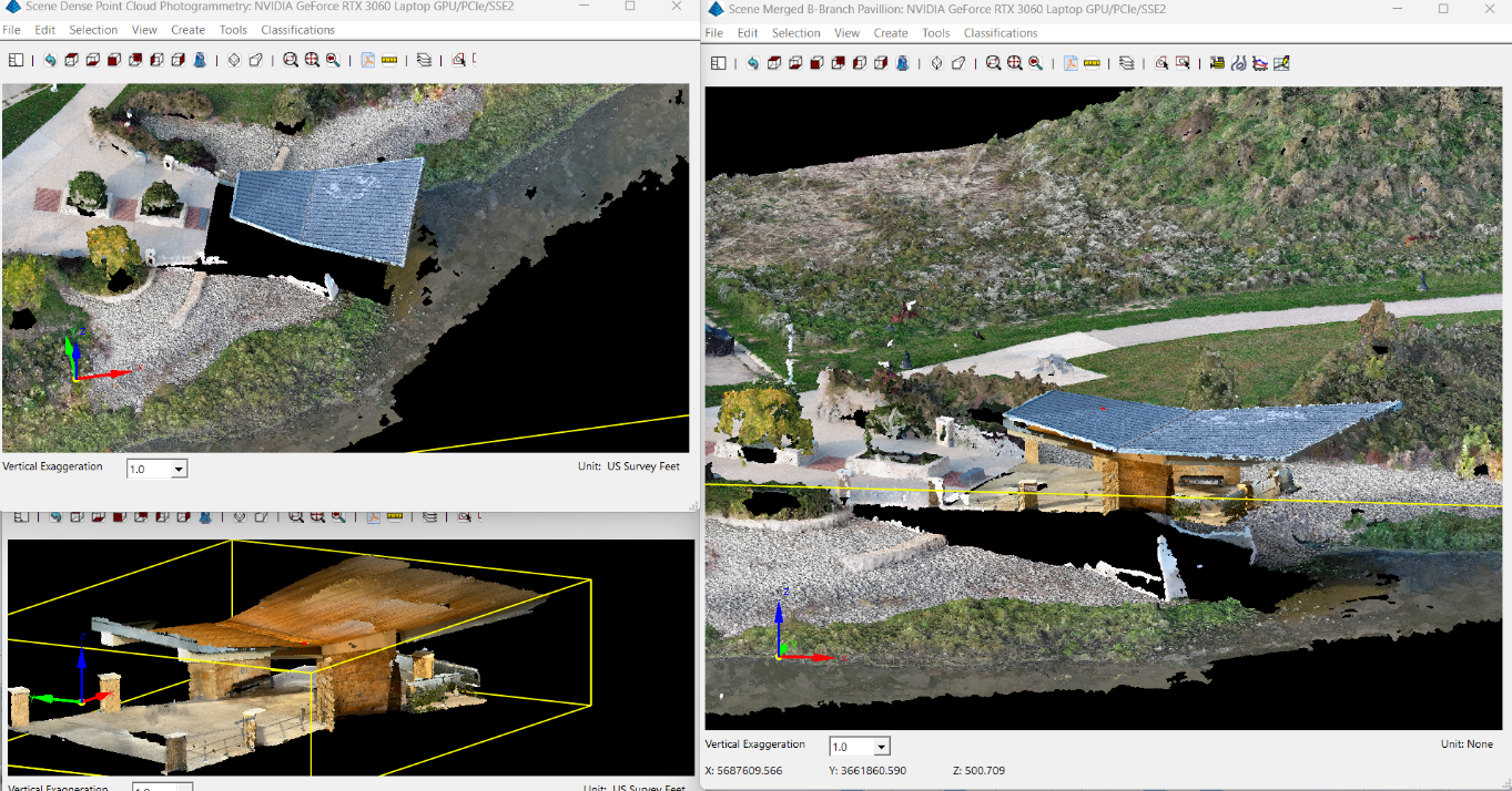
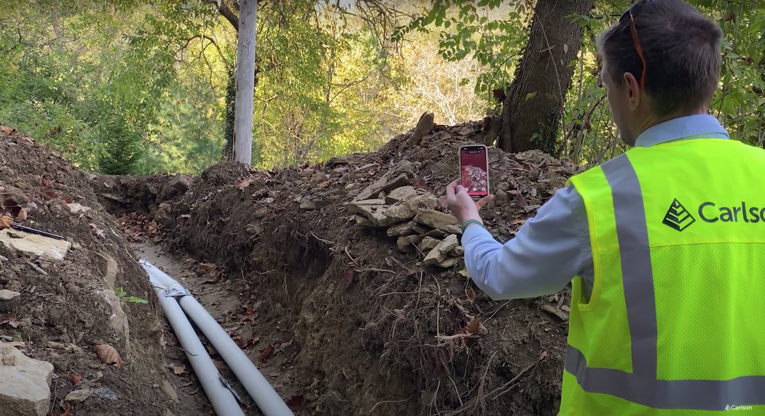
The Scan3D workflow provides a simple and affordable path to add detailed, ground-level point cloud data to other clouds, creating more complete, more accurate, and more useful scans and finished CAD deliverables. With Scan3D, users can capture culverts, drainage, vaults, manholes, structures, crime scenes, etc. with ease, and then accurately position and scale them via GNSS and other survey workflows. Those same workflows make it easy to accurately integrate Scan3D point clouds into other point cloud data of the scene, i.e. from drones or terrestrial laser scanners. An example workflow could begin with a photogrammetry drone flight to capture the majority of a site, processed to a point cloud in Carlson PhotoCapture.
The Scan3D workflow provides a simple and affordable path to add detailed, ground-level point cloud data to other clouds, creating more complete, more accurate, and more useful scans and finished CAD deliverables. With Scan3D, users can capture culverts, drainage, vaults, manholes, structures, crime scenes, etc. with ease, and then accurately position and scale them via GNSS and other survey workflows. Those same workflows make it easy to accurately integrate Scan3D point clouds into other point cloud data of the scene, i.e. from drones or terrestrial laser scanners. An example workflow could begin with a photogrammetry drone flight to capture the majority of a site, processed to a point cloud in Carlson PhotoCapture.
“I am extremely excited to partner with Carlson to bring easy to use 3D capture tools to their customers’ toolboxes” said Brian Ahern, CEO of DotProduct LLC. “For 40 years Carlson has been known for improving workflows for surveyors and civil engineers, and Scan3D is a great addition to those workflows.”
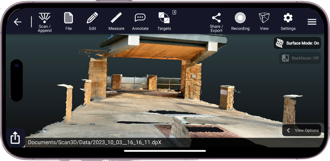
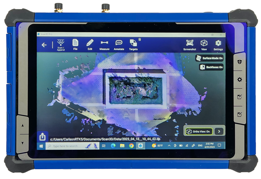
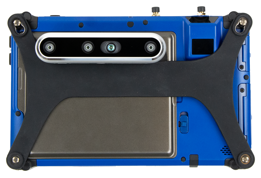
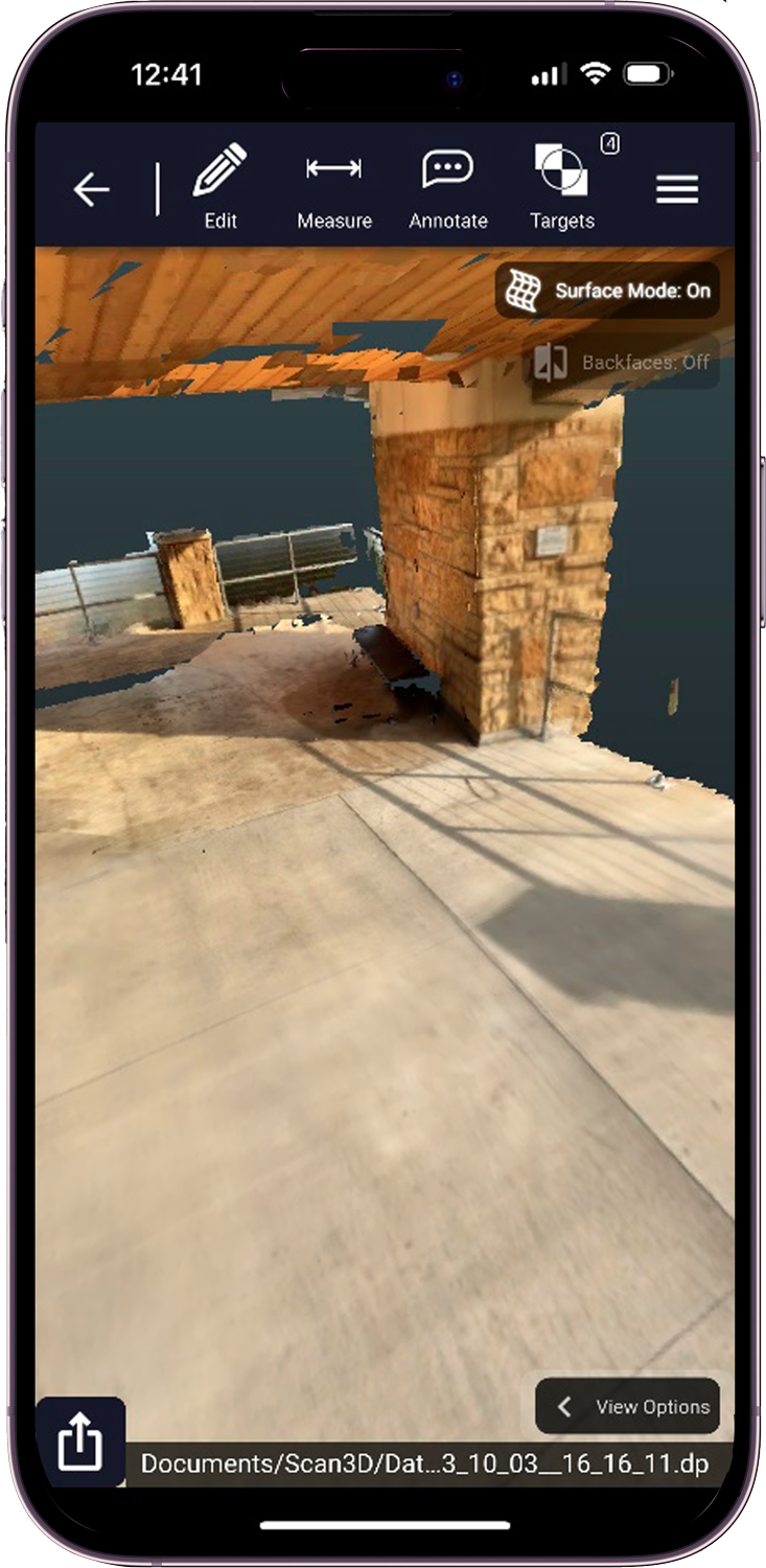
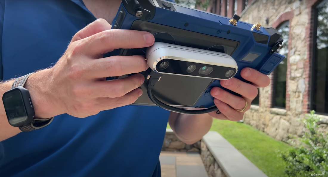
Scan3D is now available for both Windows and iOS tablets and phones. Windows-based Scan3D kits include an individually calibrated Intel® RealSense™ depth camera, directly mountable to Carlson’s RT5 or RTk5 rugged tablets. iOS-based Scan3D deployments leverage the embedded LiDAR technology built into the latest iPad Pro and iPhone Pro (and Pro Max) models. Scan3D adds a new tool to the truck for surveyors, engineers, construction professionals, accident reconstruction specialists, and anyone else needing instant, mobile 3D scanning of buildings, walls, spaces, equipment, and much more.
Scan3D is now available for both Windows and iOS tablets and phones. Windows-based Scan3D kits include an individually calibrated Intel® RealSense™ depth camera, directly mountable to Carlson’s RT5 or RTk5 rugged tablets. iOS-based Scan3D deployments leverage the embedded LiDAR technology built into the latest iPad Pro and iPhone Pro (and Pro Max) models. Scan3D adds a new tool to the truck for surveyors, engineers, construction professionals, accident reconstruction specialists, and anyone else needing instant, mobile 3D scanning of buildings, walls, spaces, equipment, and much more.
Scan3D is uniquely equipped for Carlson users via direct support for Carlson-specific survey control files, as well as support for in-app survey/civil CAD model comparison via the LandXML file format (coming soon) and support for direct import of compressed .DP point cloud files (coming soon) into Carlson Point Cloud.
"Our customers are always searching for new tools and methods to improve their accuracy, capability, and efficiency." said Butch Herter, Director of Hardware Development at Carlson Software. "The Scan3D solution provides not only a great standalone tool for scanning, but the point clouds it creates are the perfect complement to aerial or terrestrial point cloud data from any source, and integrate gracefully in Carlson's software to create more complete, more useful datasets."
"Our customers are always searching for new tools and methods to improve their accuracy, capability, and efficiency." said Butch Herter, Director of Hardware Development at Carlson Software. "The Scan3D solution provides not only a great standalone tool for scanning, but the point clouds it creates are the perfect complement to aerial or terrestrial point cloud data from any source, and integrate gracefully in Carlson's software to create more complete, more useful datasets."
Scan3D relies solely on local processing, meaning no cloud processing or internet connection is required to scan or create a finished point cloud. These resulting point clouds can be merged with larger scale clouds from sources such as terrestrial laser scanners, aerial LiDAR, or aerial photogrammetry to create a single model with accurate coverage of areas that no single device could produce.
To learn more about Carlson Scan3D, please visit carlsonsw.com/product/carlson-scan3d, or contact your Carlson Software Representative or Certified Dealer for pricing, a demo, and to purchase. Scan3D for iOS offers a 7-day free trial and can be found on the App Store here. To locate your representative or dealer, click here.
About Carlson Software Inc.
Founded in 1983, Carlson Software Inc. specializes in CAD design software, field data collection, laser measurement and machine control products for the civil engineering, surveying, GIS, construction, and mining industries worldwide, providing one-source technology solutions for the entire project cycle. Carlson Software is headquartered in Maysville, Ky., U.S.A., with branch offices in Boston, Mass.; Almere, The Netherlands; Melbourne, Australia; Ottawa, Canada; and York, England.
About DotProduct LLC
Founded in 2012, DotProduct develops high performance, easy-to-use solutions for capturing 3D data. Its flagship Dot3D software powers a full suite of handheld 3D capture solutions across the latest tablet, phone, and 3D sensing platforms. The technology is designed for mobile professionals who need quality spatial data, instantly. Dot3D software turns Android, Windows, and iOS phones and tablets into real-time 3D-capture and processing solutions for the job site. Applications include construction, shipbuilding, utilities, architecture, facility management, engineering, public safety, forensics, archaeology, and much more. For more information, please visit www.dotproduct3d.com.
 RSS Feed